
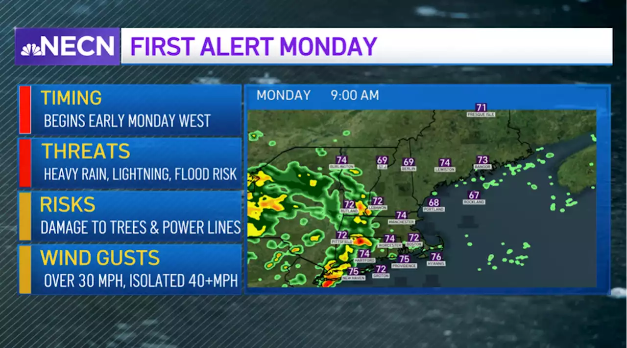
Afternoon storms may produce damaging winds, hail, heavy rain and an isolated tornado, especially in parts of western New England
In terms of rain, interior New England, including central and northern New England, may see up to 2-3 inches of rain which again, may cause some localized flooding, while eastern areas of southern New England will see half an inch to an inch of rain, with lesser amounts across southeastern Mass. and Rhode Island. At this point, any rain is a welcome sight as much of the region is dealing with a moderate drought, with severe drought conditions from Boston into northern Mass.
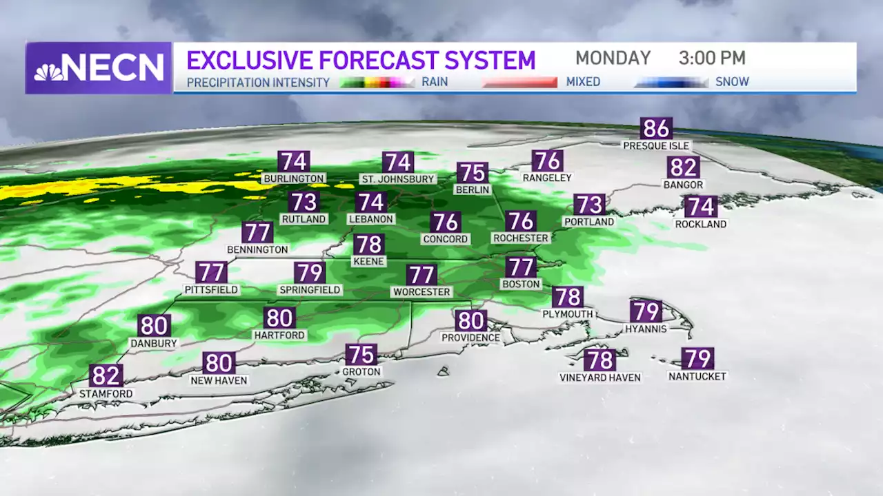
Highs will reach the upper 70s to mid 80s today along with an increasing south wind which will gust over 25 mph later this afternoon and evening. Showers, downpours, and storms will continue to shift northward overnight with the threat for severe weather diminishing during the course of the night. Winds will also be a factor as they gust out of the south over 30 mph, with higher gusts possible across the Cape and Islands. Lows in the upper 60s to low 70s.
A lingering shower or storm is possible along the coast Tuesday morning, especially over Downeast Maine, with clouds decreasing as low pressure quickly pulls away from the region. The afternoon is setting up to be hot and a bit on the humid side with highs reaching the upper 80s to low 90s along with a gusty west wind.
We’ll continue to stay hot and humid through the week, with isolated storms possible Wednesday afternoon and widespread showers and storms likely late Thursday.
Belgique Dernières Nouvelles, Belgique Actualités
Similar News:Vous pouvez également lire des articles d'actualité similaires à celui-ci que nous avons collectés auprès d'autres sources d'information.
 FIRST ALERT: Monday Brings Possibility of Heavy Rain, Damaging WindsWe’re up to quite some changes across New England in the next few days, we’ll see showers and downpours tomorrow, embedded storms and scorching heat right after. Aside from a passing shower or two this afternoon, we see mostly dry conditions, a mix of sun & clouds and a rise in humidity. Our dew points have reached the upper 60s…
Lire la suite »
 Leeds bin collection times to change on Monday and Tuesday to protect crews from extreme heatLeeds residents who have a regular bin collection on Monday are being asked to put their bins out earlier.
Lire la suite »
 Newspaper headlines: 'Meltdown Monday' and 'Race for No 10 gets personal'This week's forecast of extremely hot weather features on a number of today's newspaper front pages.
Lire la suite »
 Meltdown Monday: Britain grinds to a halt as temperatures head to 41c on hottest ever dayBritain is set to grind to a halt as it is hit by scorching 41C heat in what is likely to be the hottest ever day in the UK.
Lire la suite »
 FIRST ALERT: Isolated Showers Sunday; Severe Weather Possible MondayBreezy, warm, and humid conditions will be with us Sunday evening with a few isolated showers and thunderstorms. Most will remain dry, but keep a close eye to the sky if you have any outdoor plans through early tonight. Beyond that into tonight, most of the showers and storms will decay as we lose the heating of the sun setting…
Lire la suite »